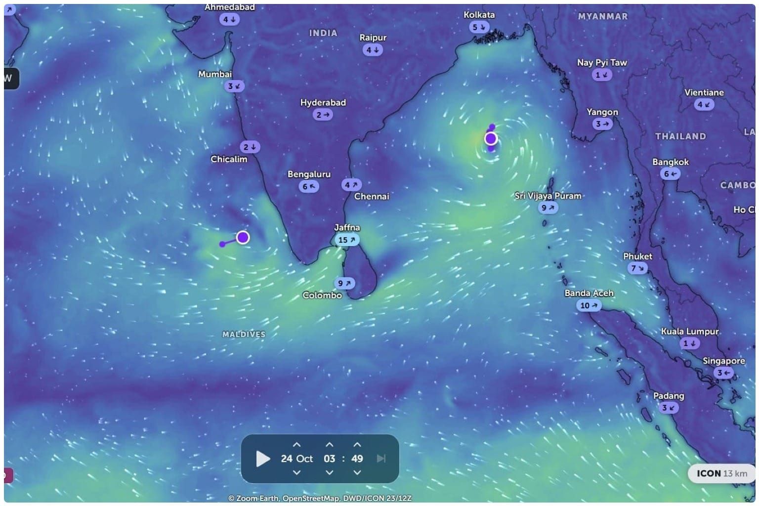
Before Arnab reaches cyclone strength, its forecast track takes the developing system first south, then west-northwest and finally northwest towards the Andhra Pradesh coast. The turn places a long stretch between Bapatla and Visakhapatnam inside the landfall corridor.
The system remained a depression early on Sunday, October 25, and therefore had not yet officially received the name Arnab. In its 2 am national bulletin, the India Meteorological Department located the centre 860 kilometres east-southeast of Visakhapatnam, moving southeast at 8 kmph with sustained winds of 40–50 kmph.
⚠️ CYCLONE ALERT: COASTAL ANDHRA PRADESH ⚠️ 🌀 Oct 26: Likely to intensify into a Cyclonic Storm over the Bay of Bengal 🌀 Oct 27: Likely to strengthen into a Severe Cyclonic Storm 🌀 Oct 28: Chance of becoming a Very Severe Cyclonic Storm and landfall over #Kakinada coast https://t.co/TgMooDqhR2
— tirupati weatherman (@TPTweatherman) October 23, 2026
IMD expects the depression to strengthen into a cyclonic storm on October 26, a severe cyclonic storm on October 27 and a very severe cyclonic storm before landfall. It is forecast to cross the Andhra Pradesh and Yanam coasts between Bapatla and Visakhapatnam by the forenoon of October 28, carrying sustained winds of 115–125 kmph and gusts reaching 140 kmph.
That forecast intensity could uproot large trees, damage power and communication lines, tear roofs from vulnerable houses and cause widespread losses to standing crops, plantations and orchards. IMD has also warned that roads, embankments and salt pans may be damaged, while small craft could be pulled from their moorings.
Rain will spread far beyond the point where the storm’s centre crosses the coast. The warning for coastal Andhra Pradesh includes isolated extremely heavy rain on October 27 and 28. Odisha faces isolated extremely heavy rain on October 28, while eastern Telangana may receive similarly intense falls. Heavy rain is forecast later across Chhattisgarh, Bihar, Jharkhand, eastern Uttar Pradesh and parts of West Bengal as the weakened system moves inland.
The concentrated downpour will follow one of India’s driest monsoon seasons in years, but cyclone rain can flood fields and damage mature crops rather than provide the gradual moisture that agriculture needs.
Along the Andhra Pradesh and Yanam coast, squally winds are forecast to begin on October 27 and rise to 90–100 kmph by evening. The sea is expected to deteriorate from rough or very rough conditions to “phenomenal” by the morning of October 28, the highest category in IMD’s sea-state terminology. A fishermen’s warning issued in Visakhapatnam advises boats to remain out of the central Bay of Bengal from October 26 and the Andhra Pradesh–Odisha coastal waters from October 27.
The name Arnab, submitted by Bangladesh, will be assigned only after the system reaches cyclonic-storm strength. Under the north Indian Ocean naming rules, that requires sustained winds of at least 34 knots, or about 62 kmph. The threshold separates an expected cyclone from one that has actually formed.
The forecast corridor remains broad. Its precise crossing point, timing and peak wind field may narrow as the circulation strengthens and approaches land. For coastal communities, preparation cannot wait for that precision: IMD has advised evacuation from exposed settlements, suspension of fishing operations and movement away from vulnerable structures.